Status: In use · November 2026
Collaboration: The LRA and Toronto Metropolitan University’s School of Urban and Regional Planning. A 2022 planning studio prepared the initial research framework; the LRA subsequently developed the detailed master plan and opportunities maps.
The Leslieville Public Realm and Open Space Master Plan sets out the LRA's priorities and opportunities for improving the neighbourhood's streets, parks, laneways and shared spaces. It connects opportunities across the neighbourhood, rather than treating each improvement as an isolated project.
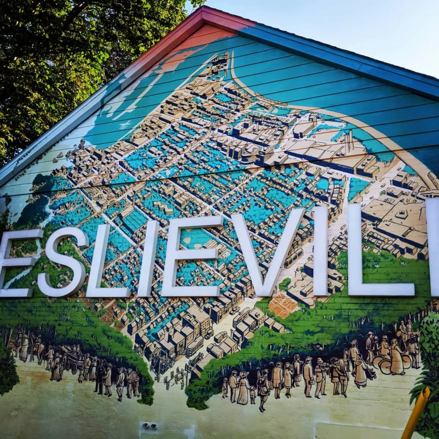
From student framework to LRA master plan
In early 2022, a planning studio at Toronto Metropolitan University’s School of Urban and Regional Planning prepared research, guiding principles and concept studies to inform the work. Following that foundation, the LRA developed the detailed master plan and coordinated opportunities maps shown below.
The LRA mapping brings together neighbourhood structure, transit, pedestrian and open-space connections, cycling, community infrastructure, green and blue infrastructure, and development. It identifies how improvements in one network can support the others.
A plan used to advance local improvements
Dundas–Dagmar pedestrian crossing
The pedestrian crossing at Dundas Street East and Dagmar Avenue is moving ahead. An early LRA advocacy priority, it supports the master plan’s emphasis on safer pedestrian connections between residential streets, parks and everyday destinations.
Bike Share expansion
The bicycle network mapping helped identify gaps in station coverage and supported the LRA's work to advance Bike Share expansion in Leslieville.
Creating and protecting cycling connections
The plan has helped prioritize advocacy for new cycling connections and the protection and enhancement of existing bike lanes. Its approach links routes with crossings, destinations and access to Bike Share.
Leslieville BIA streetscape planning
The master plan provided impetus for the Leslieville BIA Streetscape Master Plan. Opportunities identified in the LRA’s plan—including new parkettes, enhanced laneways and other public-space improvements—are being advanced through the BIA streetscape planning and implementation process. This carries the neighbourhood-wide vision into more detailed design and delivery, with individual improvements progressing at different stages.
Laneways and climate action
The mapped opportunities for laneway improvements, tree planting, blue streets and stormwater management provide a foundation for the Leslieville Laneway Project and the climate change mitigation and adaptation strategy.
Explore the LRA's seven coordinated maps
Select a map to open the full-size image, or download the complete set to examine its symbols, priorities and explanatory notes.
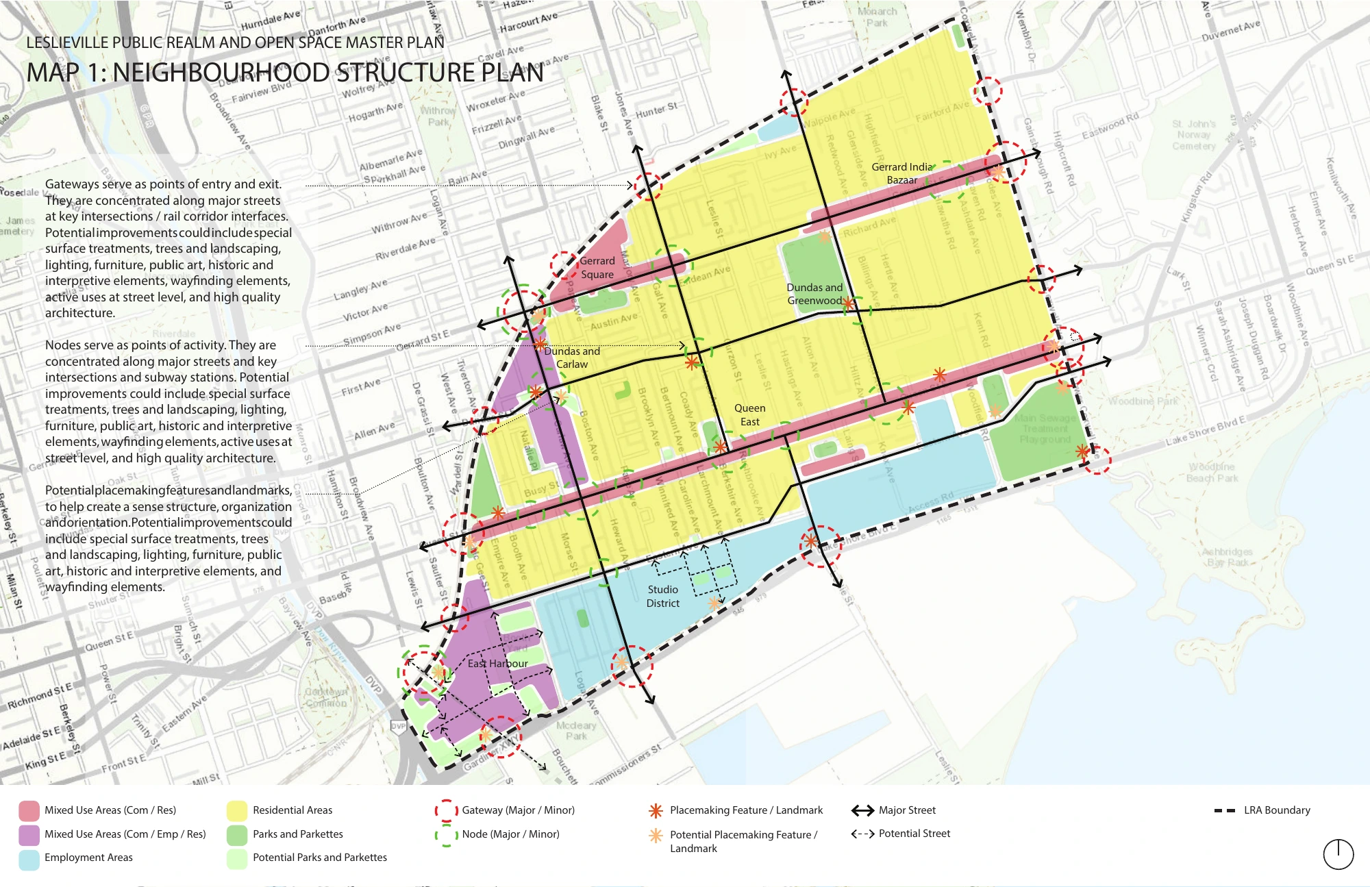
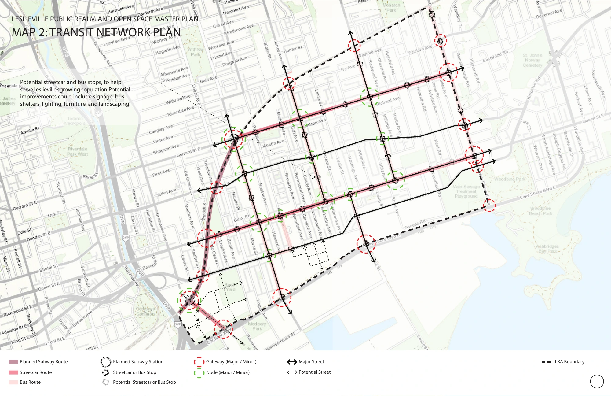
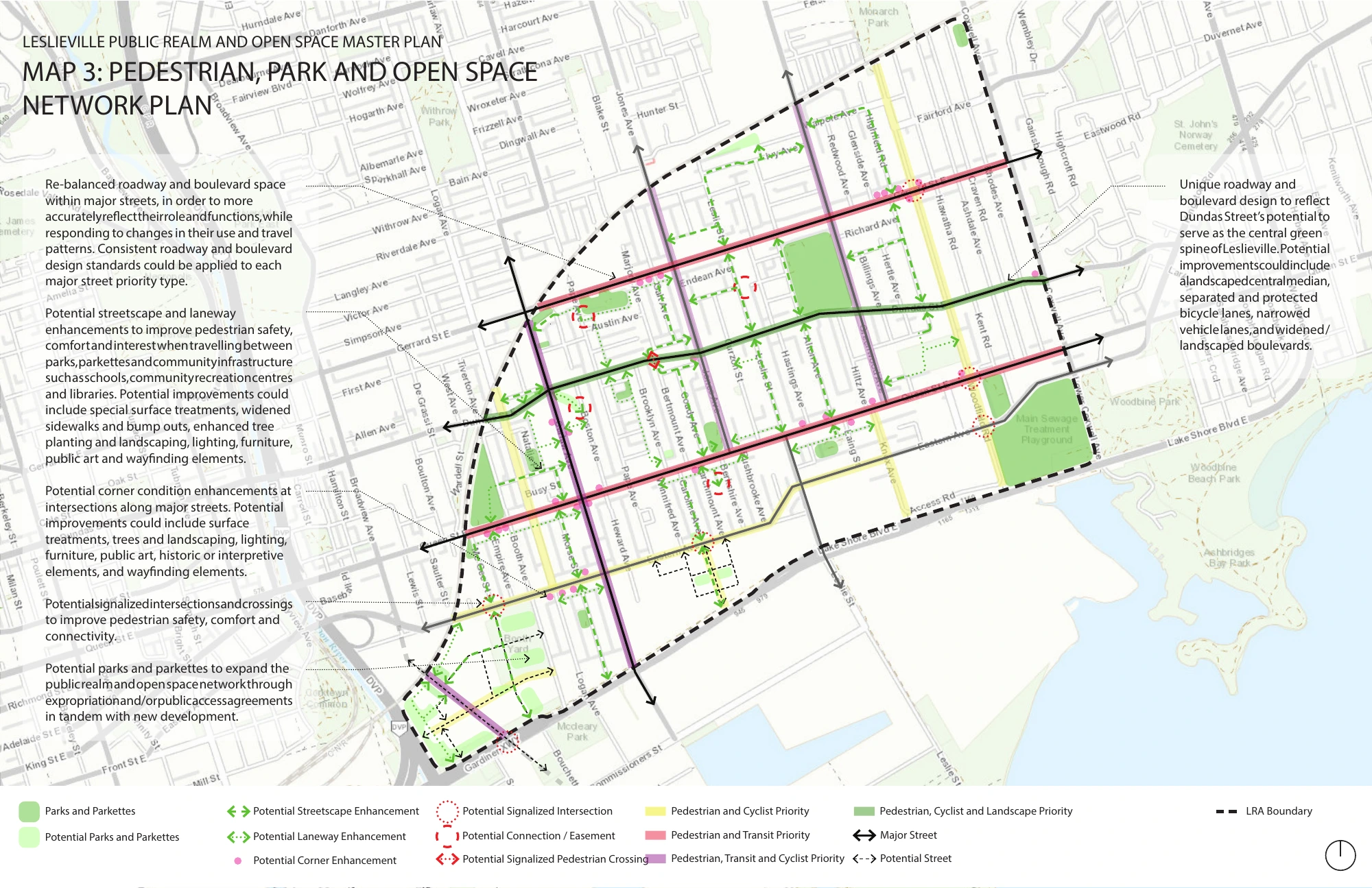
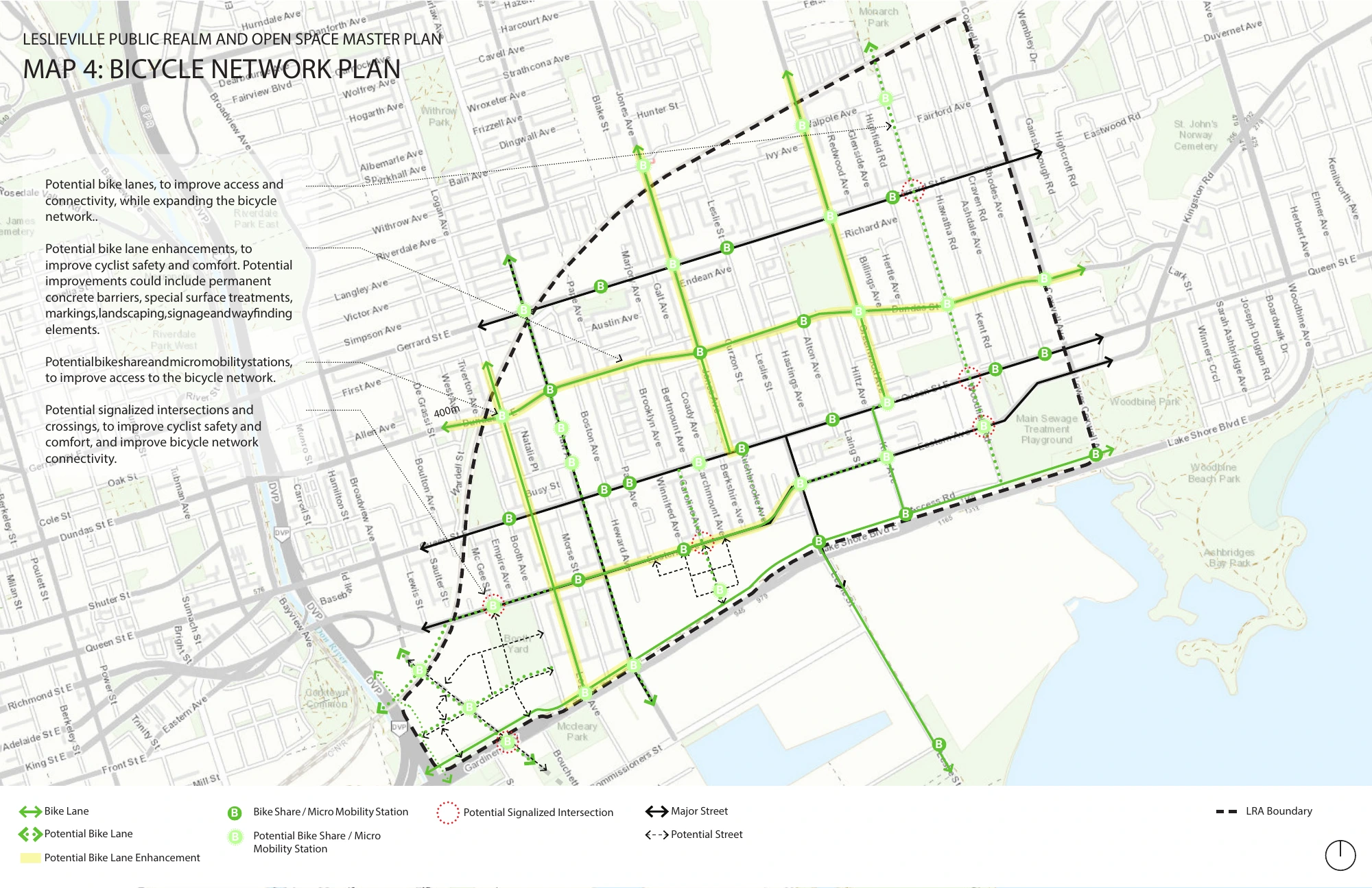
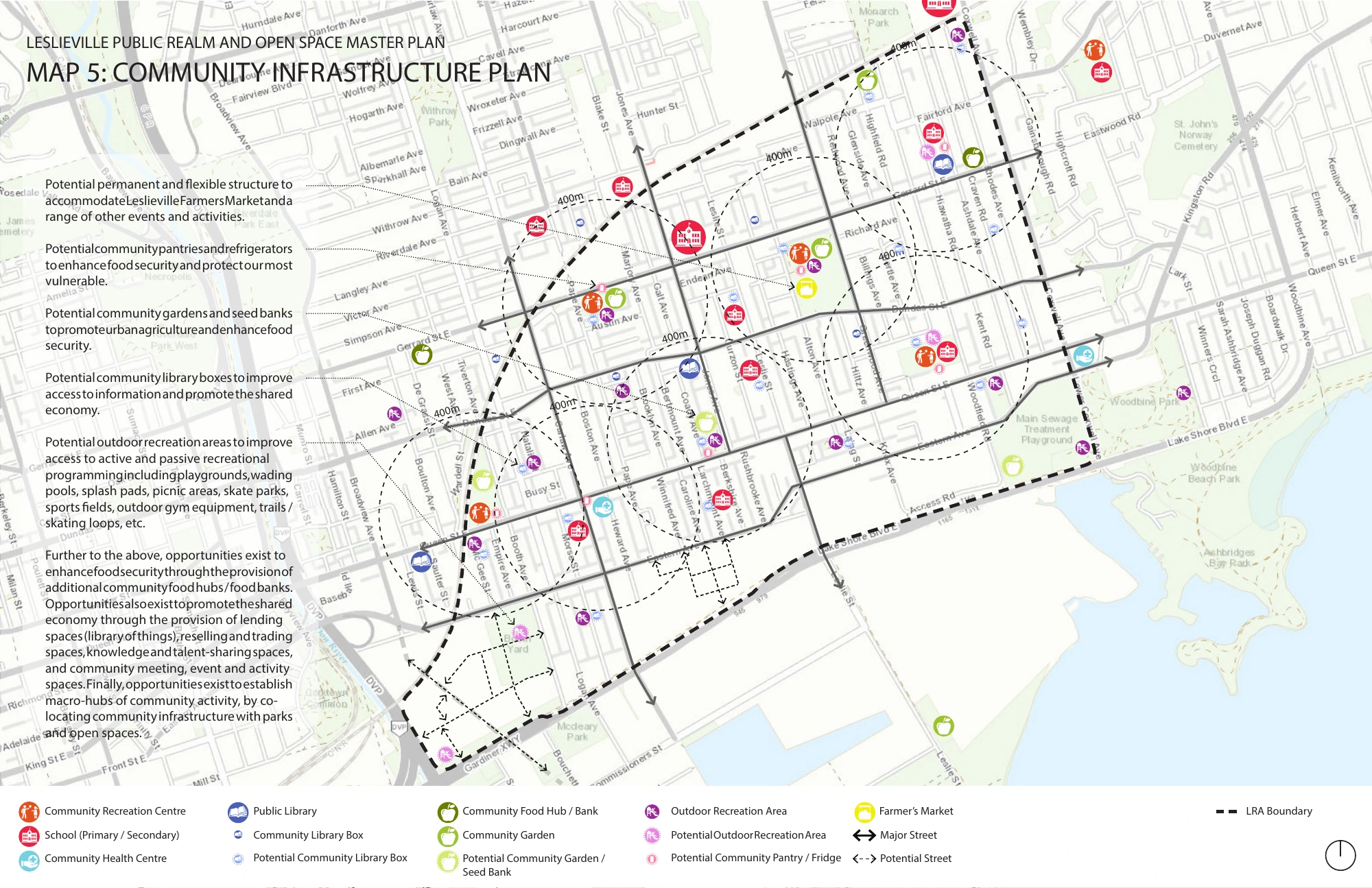
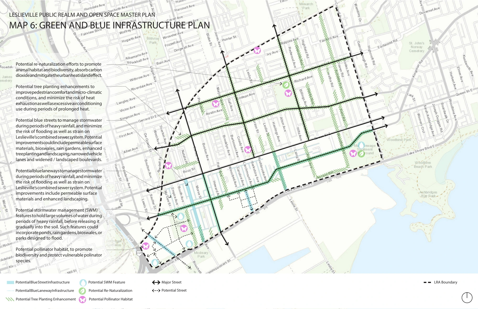
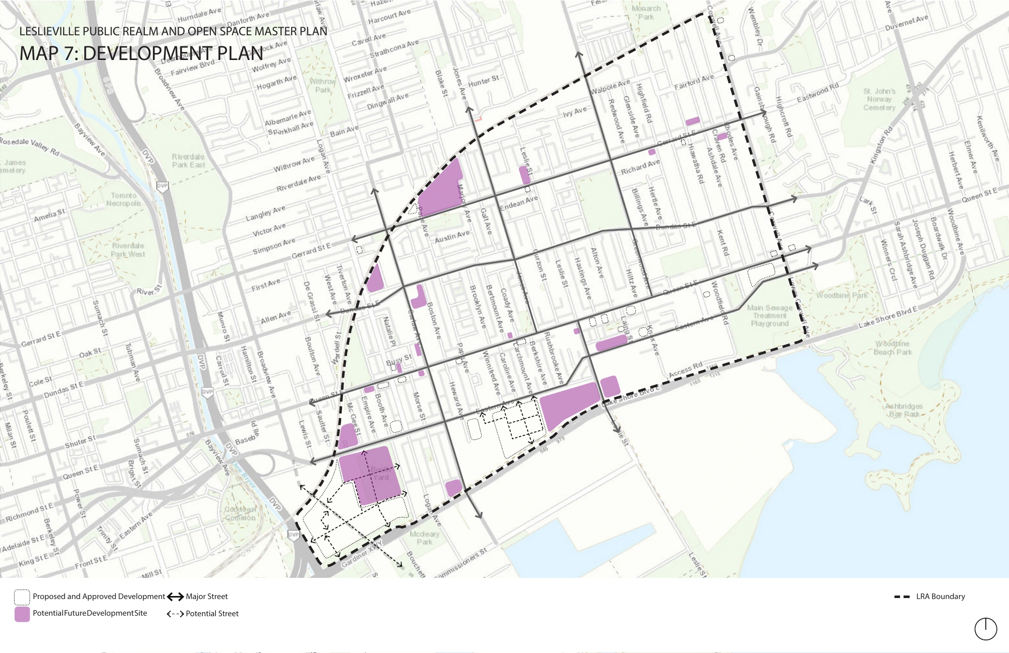
Prepared by the Leslieville Residents Association following the student framework. This map set dates from 2022; existing conditions and proposed opportunities are shown as recorded at that time.
The student framework that informed the plan
The April 2022 studio work explored mobility, gathering spaces and ecological systems, including concept studies for Greenwood Park and Queen Street East at Jones Avenue. Tura Cousins Wilson and Craig Race served as LRA client representatives, with Blair Scorgie supervising the studio.
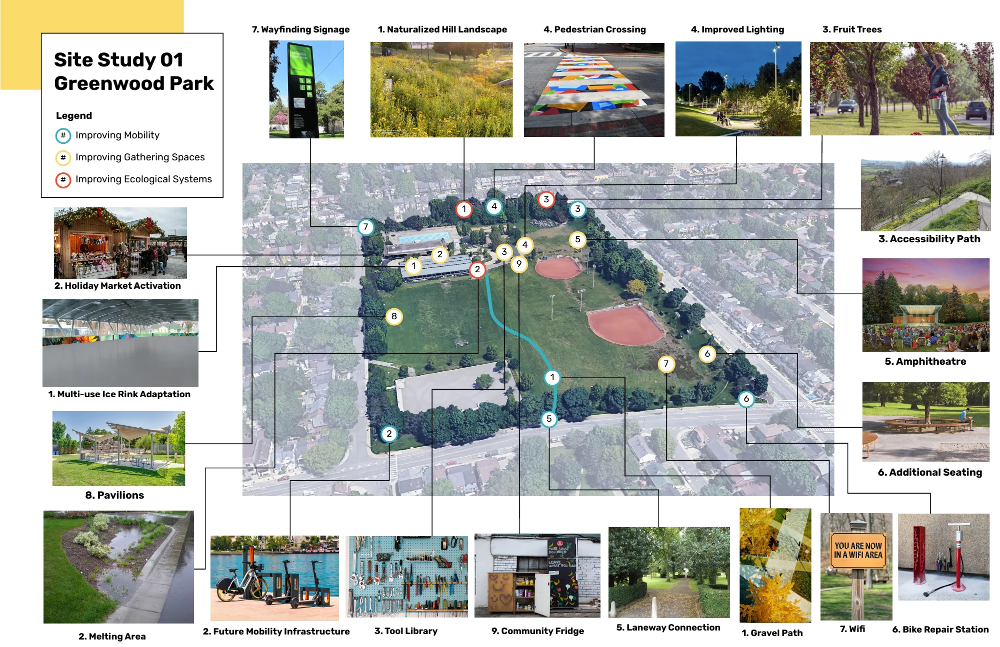
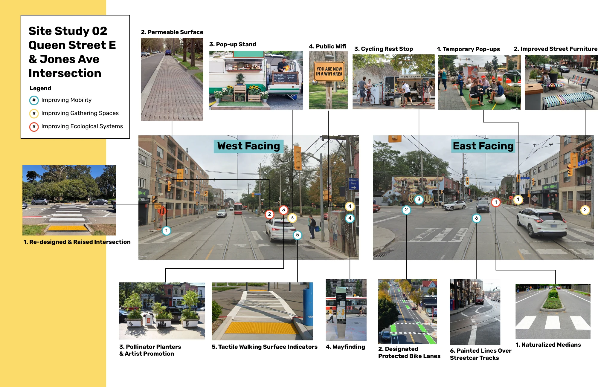
Student team: Julia Bevacqua, Vanessa Cipriani, Jao Dantes, Konain Edhi, Cameron McCoy and Lauren White. Underlying image credits are retained in the source report.
Download the April 2022 student report · PDF, 24 MBHelp advance the next priorities
Tell us which mapped opportunities matter most to you, what has changed and where you would like to help move an idea forward.
Share your priorities